| GIS Analyst at Dillon Consulting Ltd. | JUL 2024 to PRESENT |

Automating complete geospatial workflows and building command line tools using Python (open
source libraries, ArcGIS API for python and arcpy), reducing manual processing time from several
hours to minutes, and generating standalone dynamic HTML reports and interactive maps.
Developing end-to-end ML pipelines for diverse tasks leveraging satellite and drone imagery.
Streamlining data analysis and preprocessing by automating tasks through ESdat's OData Feeds.
Contributing to technical workflow documentation and proposal development, including effort
estimation and budgeting, helping tailor the solutions to meet client needs and industry
standards.
Automating workflows with ArcGIS API for Python and Arcpy to publish layers and services to the
ArcGIS Enterprise portal, ensuring accurate and consistent data management.
Providing technical support to GIS components for both internal and external projects including
data management, spatial analysis, and visualizations, utilizing various GIS tools and
softwares.
Conducting comprehensive research and assessing a range of GIS software solutions to enhance and
manage existing systems and drive innovation in technical systems and applications.
Collaborating closely with multidisciplinary project teams, including planners and engineers, to
integrate GIS solutions into larger project frameworks.
Contributing to the development and continuous improvement of innovative technical systems,
standards, and procedures, ensuring high efficiency and maintaining quality in all deliverables.
| Founder & Educator at StratagemGIS Solutions | APR 2024 to PRESENT |
Creating and sharing educational content on LinkedIn, focusing on python and geospatial analysis
to engage the professional audience through various informative and practical posts.
Developing and publishing Python notebooks that demonstrate advanced GIS techniques, promoting
interactive learning and providing practical skills in geospatial analysis.
| Geomatics Technical Lead at SceneSharp Technologies Inc. | MAR 2020 to FEB 2024 |

Played a key role in conceptualizing and crafting innovative project workflows that improved
efficiency, alignment with client needs and industry standards; Assisted in drafting various
project proposals that secured more than $400,000 CAD funding from government agencies.
Contributed efficient, timely, and reliable ideas for research and development by employing
python workflows to automate diverse image processing, geoprocessing, and AI/ML tasks.
Developed remote sensing based AI products using test-driven development with pytest, and mlflow
to track experiments for better model performance improvement and optimization.
Migrated an entire product’s codebase from Java to Python with few parts of the product in Rust,
improving code security and maintainability to enhance rapid prototyping and testing.
Designed Python workflows to automate downloading and pre-processing satellite imageries.
Mentored interns by actively guiding project workflows and conducting thorough code reviews.
Actively participated in the continuous improvement of development processes by proposing and
implementing innovative solutions.
Adhered to GitHub workflows to enhance project features through structured pull requests and
code reviews. Utilized Kanban boards and Agile methodologies for effective project management,
facilitating smooth team coordination and timely delivery of project milestones.
Proactively researched and recommended new technologies and tools to improve development
processes, identifying solutions that streamlined workflows and improved efficiency.
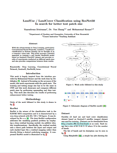
Reviewed remote sensing and deep learning literature papers, implementing and evaluating deep
learning models using AI frameworks. Conducted both visual and statistical interpretations of
results and probability maps, examining model performance.
Inspected and fine-tuned training data for ML models, preparing imagery and extracting features
for ML and deep learning tasks using Python. Created aesthetic map layouts and effectively
managed ArcGIS Pro projects, geodatabases, imagery, and results.
Effectively developed Python scripts that adhere to PEP8 style guidelines, maintaining and
collaborating on code with the team using GitHub.
| 🔥 [365 Data Science] Data Analyst Career Track - Verify | NOV 2023 |
| 🔥 [EADA19-001] Esri Core Technical Certification: ArcGIS Desktop Associate - Verify - Esri Directory | FEB 2021 |
| 🔥 [PCAP-31-03] OpenEDG Python Institute: Certified Associate in Python Programming - Verify | DEC 2020 |
